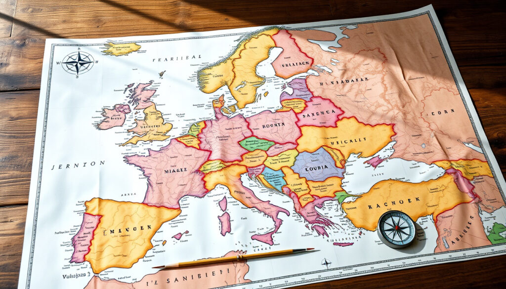
Map of Europe Countries – Labeled, Printable and Interactive Guide
Europe encompasses approximately 44 to 50 sovereign states, depending on how disputed territories are counted. The continent covers roughly 10.18 million square kilometers and is home to around 750 million people. For anyone studying European geography, a map of Europe countries serves as an essential reference tool, whether for academic purposes, travel planning, or simply understanding the political landscape of the region.
The question of how many countries are in Europe does not have a single definitive answer. Multiple authoritative sources, including geographic databases and international organizations, offer varying counts based on their criteria for state recognition. Understanding these distinctions helps clarify why different maps may show different numbers of countries.
This guide provides a comprehensive overview of European nations, the various types of maps available, and the geographic versus political considerations that shape how Europe is defined and represented.
What Countries Are in Europe?
A standard reference list recognizes 44 widely accepted sovereign states on the European continent. This number forms the foundation for most educational and official maps, though certain territories and partial recognitions can push the count higher depending on interpretation.
- Europe comprises between 44 and 50 states, with variations based on recognition of disputed territories
- The European Union contains 27 member states following the United Kingdom’s departure in 2020
- The continent spans approximately 10.18 million square kilometers
- Russia’s European territory accounts for a significant portion of the landmass
- Several microstates such as Monaco and Liechtenstein maintain full sovereignty despite their size
- Kosovo’s status remains contested, with recognition varying among UN member states
- Cyprus has been divided since 1974, creating complications for geographic mapping
| Country | Capital | Country | Capital |
|---|---|---|---|
| Albania | Tirana | Italy | Rome |
| Austria | Vienna | Latvia | Riga |
| Belgium | Brussels | Lithuania | Vilnius |
| Bulgaria | Sofia | Netherlands | Amsterdam |
| Croatia | Zagreb | Norway | Oslo |
| Czechia | Prague | Poland | Warsaw |
| Denmark | Copenhagen | Portugal | Lisbon |
| Estonia | Tallinn | Romania | Bucharest |
| Finland | Helsinki | Serbia | Belgrade |
| France | Paris | Spain | Madrid |
| Germany | Berlin | Sweden | Stockholm |
| Greece | Athens | Ukraine | Kyiv |
Types of Maps of Europe Countries
Cartographers and educational platforms offer several distinct varieties of European maps, each serving different purposes. Selecting the appropriate map type depends largely on the intended use, whether for study, navigation, or quiz preparation.
Political Maps of Europe
Political maps emphasize national boundaries, capitals, and major cities. These maps are the most common representation found in classrooms and news publications. Resources from the GIS Geography project provide detailed political maps showing countries, capitals, highways, and rivers across the continent.
The Ordnance Survey offers an interactive PDF outline that allows users to toggle between different layers, showing boundaries, country names, and capital cities. This flexibility makes it particularly useful for educational settings where different levels of detail are needed.
Blank and Labeled Maps
Blank maps of Europe serve educational purposes, particularly for geography quizzes and testing knowledge of country locations. The Ultimaps platform provides high-resolution blank maps available in PNG, PDF, and SVG formats. These can be printed for classroom use or customized with color schemes.
Labeled maps, by contrast, identify every country and often include additional information such as major waterways, mountain ranges, and neighboring regions. The University of Alabama’s map collection offers both labeled and black-and-white versions suitable for various educational applications.
Printable and Downloadable Resources
For those requiring physical copies, multiple sources provide printable maps of European countries. The Free World Maps website offers colored, labeled PDFs and SVG files that can be edited in design software like Illustrator. These resources include representations of disputed territories such as Kosovo and Cyprus.
When selecting a map for educational quizzes, consider using blank versions from Seterra and GeoGuessr, which provide numbered and quiz-format maps covering 44 or more countries.
Geographical vs Political Definitions of Europe
The question of what constitutes Europe involves both geographical and political dimensions. Understanding these distinctions explains why some countries appear on certain maps but not others.
The Geographical Boundaries of Europe
Geographically, Europe is typically defined as the region west of the Ural Mountains, south of the Arctic Ocean, north of the Mediterranean Sea, and west of the Ural River. The United Nations Statistics Division provides methodology for categorizing countries by region, though these classifications remain somewhat arbitrary given the continuous landmass of Eurasia.
The Question of Turkey
Turkey presents a transcontinental challenge for mapmakers. While only approximately 3 percent of Turkey’s total area falls in Europe, the country maintains significant cultural and political ties to the continent. Most European maps include Turkey’s Thracian region, though Turkey itself is not a member of the European Union and is not included in EU-specific maps.
Disputed Territories and Their Impact
Kosovo declared independence in 2008 and has been recognized by over 100 United Nations member states. However, Serbia, Russia, and China do not recognize Kosovo’s sovereignty, which affects how it appears on official maps. The Free World Maps resource includes Kosovo on its European maps, while others omit it.
Cyprus has remained divided since 1974, with the Republic of Cyprus controlling the southern portion and the Turkish Republic of Northern Cyprus holding the north. Only Turkey recognizes the northern administration, creating complications for European Union representation, as Cyprus is an EU member state despite its territorial division.
The depiction of Kosovo and Northern Cyprus on maps varies significantly between sources. Political maps intended for official or diplomatic use may exclude these territories, while educational and reference maps often include them with appropriate labeling.
Countries in Europe by Population and Size
European nations vary dramatically in both land area and population. Understanding these variations provides context for why certain countries dominate discussions of European affairs while others receive less attention despite their sovereignty. A complete list of European countries offers deeper insight into this diversity.
The Largest Nations by Land Area
Russia contains the largest European landmass, though only a portion of its total territory lies west of the Ural Mountains. European Russia accounts for approximately 144 million people within the continent’s total population of roughly 750 million. The World Population Review provides detailed demographic breakdowns for each European nation.
Population Distribution Across Europe
The European Union alone represents approximately 448 million people, making it a significant demographic bloc within the continent. Germany, France, and the United Kingdom historically served as the most populous EU members before Brexit reduced the bloc’s total population.
The Smallest Sovereign States
Several microstates maintain full sovereignty despite their diminutive size. Monaco, San Marino, Liechtenstein, Andorra, and Vatican City represent independent nations with unique political arrangements. These states are consistently included in lists of European countries despite lacking the territorial extent of their larger neighbors.
When comparing European nations, remember that population figures vary by source and may reflect different census years or estimation methodologies. The CIA World Factbook provides standardized demographic data across all recognized states.
Key Changes in European Borders
European borders have undergone significant transformation throughout history, with particular volatility in the twentieth and twenty-first centuries. Understanding these changes contextualizes current boundaries and ongoing territorial discussions.
- 2004 EU Expansion: Ten countries joined the European Union, including Poland, Hungary, and the Baltic states, significantly expanding the bloc’s eastern boundary.
- 2007 EU Expansion: Romania and Bulgaria became EU members, extending the union further eastward.
- Yugoslavia Dissolution: The breakup of Yugoslavia during the 1990s created several new sovereign states, including Croatia, Slovenia, Bosnia and Herzegovina, Serbia, Montenegro, and North Macedonia.
- 2013 EU Expansion: Croatia became the most recent country to join the European Union.
- Brexit (2016-2020): The United Kingdom voted to leave the EU in 2016 and formally departed in January 2020, reducing EU membership to 27 states.
- Kosovo Independence (2008): Kosovo declared independence from Serbia, though its status remains contested internationally.
- Crimea Annexation (2014): Russia’s incorporation of Crimea from Ukraine remains unrecognized by most of the international community.
What Is Established and What Remains Uncertain
Established Information
- 44 countries are widely recognized as sovereign European states
- Europe covers approximately 10.18 million square kilometers
- The continent has a population of roughly 750 million people
- The European Union contains 27 member states following Brexit
- The United Kingdom formally left the EU in January 2020
- Several sources list up to 47 countries when including disputed entities
Remaining Ambiguities
- The precise count varies by source due to different recognition criteria
- Kosovo’s sovereignty is recognized by roughly half of UN member states
- Cyprus’s division complicates representation on political maps
- Turkey’s inclusion in European maps varies by source and context
- Ongoing Russian-Ukraine tensions may affect future territorial representations
Understanding Europe’s Continental Boundaries
Europe’s definition as a continent is largely a convention rather than a strict geographical designation. Unlike continents separated by oceans, Europe shares a continuous landmass with Asia, making the Ural Mountains and the Ural River the most commonly cited boundaries between the two.
This arbitrary division dates to ancient Greek geographers who distinguished Europa from Asia. Today, the distinction serves cultural, political, and historical purposes rather than strict geographic ones. The comprehensive Wikipedia list documents how different sources handle these boundary questions.
Key Sources and Reference Material
Several authoritative organizations provide the data underlying most European maps and country lists. The European Commission maintains official statistics at its information portal, while the United Nations provides standardized regional classifications used by governments and researchers worldwide.
Europe comprises the westernmost peninsula of the Eurasian supercontinent, with the Ural Mountains and Ural River serving as its conventional eastern boundary.
— United Nations Statistics Division, M49 Standard Country or Area Codes
These sources generally agree on the core list of approximately 44 countries while differing on how to handle disputed territories, microstates, and transcontinental nations like Turkey and Russia.
The Essential Takeaways
A map of Europe countries reveals a continent defined as much by history and politics as by geography. While roughly 44 sovereign states are widely recognized, the actual count depends on which territories and partial recognitions one includes. The European Union, now comprising 27 members following the United Kingdom’s departure, represents one of several frameworks for understanding European identity.
For those seeking to understand or use European maps, the choice of map type—political, blank, labeled, or printable—should align with the specific purpose at hand. Educational quizzes benefit from blank maps, while research and travel planning may require more detailed labeled versions.
Whether examining France’s position in Western Europe or studying how the United Kingdom’s departure reshaped continental politics, maps remain indispensable tools for visualizing this diverse and historically complex region.
Frequently Asked Questions
How many countries are in Europe?
Most sources recognize 44 sovereign European countries. However, depending on how disputed territories like Kosovo are counted, some lists include up to 50 states.
Where can I find a printable map of Europe countries?
Resources like Free World Maps, Ultimaps, and GeoGuessr offer printable PDFs in various formats, including blank, labeled, and quiz versions suitable for educational use.
Is Turkey considered part of Europe?
Turkey straddles Europe and Asia, with approximately 3 percent of its territory in Europe. It is often included on European maps, particularly for geographic purposes, though it is not an EU member state.
How did Brexit affect the number of EU countries?
The United Kingdom left the European Union in January 2020, reducing EU membership from 28 to 27 states.
What is the largest country in Europe by area?
European Russia represents the largest portion of any European country. If counting only countries entirely within Europe, Ukraine and France are among the largest.
Why is there disagreement about the number of European countries?
Different sources use different criteria for state recognition, particularly regarding disputed territories like Kosovo and Northern Cyprus, as well as microstates and transcontinental nations.
What is the total population of Europe?
Europe has a total population of approximately 750 million people, including approximately 448 million in the European Union and roughly 144 million in European Russia.
More related posts
 Bridget McKenzie: Age, Family, Political Career
 How to Cook Pork Spare Ribs: Oven, Slow Cooker, Air Fryer
 Sub Zero Meaning: Temperature, Mortal Kombat & Luxury Brand
 Erika Frantzve: Biography, Ethnicity, Religion and Life Story
 Super Smash Bros – Complete History Games and Play Guide
 Block Out Blinds: Types, Benefits & Installation Guide
 Margaret Pomeranz: Life, Legacy & David Stratton Tribute
 Cast of The Beekeeper – Full List and Role Breakdown
